Abergwesyn Common

Abergwesyn, Llanwrtyd Wells LD5 4TP, UK
1-99 Years

Description

Abergwesyn Commons stretch for 12 miles between the Nant Irfon valley in the west and Llanwrthwl in the east. Drygarn Fawr is the highest point on the commons, lying above the Nant Irfon valley. From its summit it's possible to walk eastwards along the entire ridge almost on the level. To the south, complex, steep - and sometimes craggy - valleys dip and sweep away from the ridge. To the north the ground falls away more gently to the edge of the Elan Valley reservoir. 

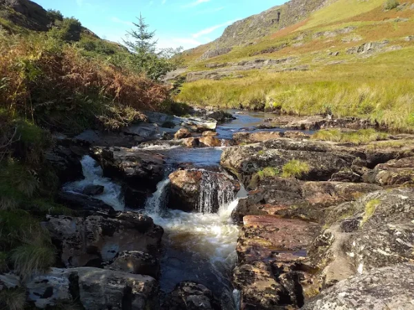
Walking along the bottom of these sheltered valleys, alongside rushing streams and through mature Oak woods, it's difficult to believe it's the same place. Wild, remote and ancient The summit ridge is a wild and bleak landscape with grand, spacious, expansive views across the roof of Wales. A walk across Abergwesyn can bring the experience of solitude, loneliness, remoteness or freedom in equal measure. 

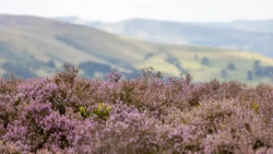
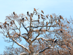
The commons are rich in archaeology, from Bronze Age ritual sites to deserted medieval villages. Wherever you walk you're likely to come across a cairn - a stone circle - or standing stone and other evidence of human activity dating back hundreds, if not thousands, of years. You can spy Red Grouse amongst the heather, and watch out for Lapwing, Golden Plover and Red Kite. Abergwesyn is altogether a truly splendid place. If you’re looking for the best place to visit with family and kids, this is a perfect choice for a fun and relaxing day out.

Features

  • Free
  • Host birthday parties: No

Features

  • Mountain: A wild, remote and ancient landscape with evidence of human settlement dating back thousands of years.
  • Exploring the countryside: Abergwesyn Commons in Powys is a vast wilderness, where you can discover glorious walks and fascinating ancient remains that offer windswept tranquillity across seven wildlife-rich commons.
  • Abergwesyn Commons stretch for 12 miles between the Nant Irfon valley in the west and Llanwrthwl in the east. Drygarn Fawr is the highest point on the commons, lying above the Nant Irfon valley. From its summit it's possible to walk eastwards along the entire ridge almost on the level. To the south, complex, steep - and sometimes craggy - valleys dip and sweep away from the ridge. 
  • To the north the ground falls away more gently to the edge of the Elan Valley reservoir. Walking along the bottom of these sheltered valleys, alongside rushing streams and through mature Oak woods, it's difficult to believe it's the same place. Wild, remote and ancient The summit ridge is a wild and bleak landscape with grand, spacious, expansive views across the roof of Wales. 
  • A walk across Abergwesyn can bring the experience of solitude, loneliness, remoteness or freedom in equal measure. The commons are rich in archaeology, from Bronze Age ritual sites to deserted medieval villages. Wherever you walk you're likely to come across a cairn - a stone circle - or standing stone and other evidence of human activity dating back hundreds, if not thousands, of years. You can spy Red Grouse amongst the heather, and watch out for Lapwing, Golden Plover and Red Kite. Abergwesyn is altogether a truly splendid place.

Facilities

Dogs allowed: Welcome on leads, please be aware of livestock.

What to see

Top trails: 
Llanwrthwl horseshoe walk: This trail begins and ends in the quiet village of Llanwrthwl and takes in panoramic views across the uplands of Brecon and Radnorshire, including the 'roof of Wales', the Cambrian mountains.

Price

Price: Free

Birthday Parties

Offer Birthday Parties: No

Countryside: Dawn - Dusk
Time may vary please check here: https://www.nationaltrust.org.uk/visit/wales/abergwesyn-common#place-opening-times

Address: Abergwesyn, Llanwrtyd Wells LD5 4TP, UK

Post Code: LD5 4TP

Council: Powys

County: Powys

  • By road: The A470 from Builth to Rahayder passes close to the village of Llanwrthwl, which is close to the eastern end of the property. The B4358 running southwest from Newbridge on Wye (also on the A470) takes you to the village of Beulah. From there drive northwest to the Nant Irfon valley; a spectacular valley and steep winding road that leads over the Devil's Staircase and eventually on to Tregaron. The Nant Irfon valley is at the extreme western end of the property. Other small lanes can lead you to the edges of the property
  • On foot: There are many access points onto the common. The Wye Valley long distance trail cuts along the eastern boundary of the property. This 136-mile trail is way-marked by the distinctive 'leaping salmon' logo and runs from the source of the River Wye in mid-Wales all the way to the mouth of the river near Chepstow Castle.
  • By train: Given its remoteness this is a hard property to get to and from by public transport, but there are railway stations at Llanwrtyd (4 miles), Llangammarch (4 miles) and Sugar Loaf (5½ miles).
  • By bus: Given its remoteness this is a hard property to get to and from by public transport, however the Number 100 from Llandrindod Wells to Abergwesyn Old Post Office runs twice daily Monday to Friday.
  • Cycling: National Cycle Route 8 (on-road) passes within 3 miles of the eastern boundary of the property and runs from Cardiff to Holyhead, passing through the heart of Wales. It links with route 42 on the banks of the River Wye. The roads along this route are usually quiet but can be busy in some sections. This route is quite strenuous and generally for the more experienced cyclist. Follow the route to the B4358 and from there onto the property.

0

0 Reviews

Rating breakdown

5
80% Complete (danger)
0
4
80% Complete (danger)
0
3
80% Complete (danger)
0
2
80% Complete (danger)
0
1
80% Complete (danger)
0

Get the best blog stories into your inbox!