Description
St. Declan's Way is a premier historical and spiritual walking trail linking the historic towns and rolling countryside of County Tipperary and County Waterford in Ireland. Often described as "Ireland's Camino," this magnificent 115-kilometre ancient pilgrim path follows the fifth-century route taken by Saint Declan when he travelled to Cashel to meet Saint Patrick. Today, the fully waymarked trail is sanctioned by Sport Ireland, providing modern explorers with a beautiful balance of dramatic mountain terrain, rich early Christian heritage, and rural scenery.
Securing your passport or booking onto organized group walks is straightforward, with clear local frameworks overseen by the voluntary St. Declan's Way Steering Committee. The official pilgrim passport and individual collection stamps are completely free of charge, courtesy of Waterford County Council, and can be collected at key stops along the route. For walkers looking for a fully supported experience, Knockmealdown Active organizes an annual 6-stage guided walking event across three spring weekends, with registration priced at €45 per individual stage or a flat rate of €250 for the entire route.
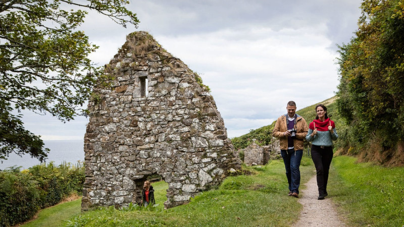
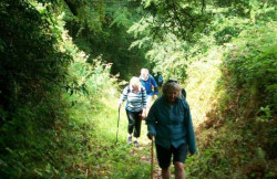
If you are looking for an immersive long-distance activity that combines fascinating Irish history with fresh air and physical challenge, this cross-county trail is an essential itinerary addition. The route places a major emphasis on community connection, allowing walkers to follow the blue trail waymarkers through monastic ruins, riverside paths, and ancient mountain gaps. It is a wonderful way to step back in time, cross the spectacular Knockmealdown Mountains, and finish with a peaceful beachside stroll to St. Declan’s Monastery in Ardmore.
Features
- Free
- Host birthday parties: No
Features
What Makes St. Declan's Way Unique?
- The Footsteps of Saints: The path directly preserves the historical fifth-century route walked by Saint Declan to meet Saint Patrick in Cashel, predating many European pilgrimage routes.
- The "Ireland's Camino" Passport: Walkers can carry a dedicated pilgrim passport, collecting unique stamps at village shops, bakeries, and heritage centres along the path.
- Ancient Intersecting Highways: The modern route utilizes several historic highways, including the Rian Bó Phádraig (Track of St. Patrick's Cow) and Bóthar na Naomh (Road of the Saints).
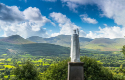
- From Inland Rock to Coastal Sea: The trail begins at the iconic, high-altitude Rock of Cashel and finishes dynamically along the sandy beach of the Celtic Sea in Ardmore.
Detailed Highlights
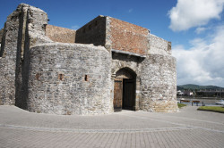
- The Rock of Cashel: The magnificent starting point of the trail; once the ancient seat of the High Kings of Munster and a spectacular hub of medieval ecclesiastical architecture.
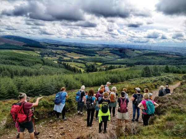
- The Knockmealdown Mountain Pass: Stage 3 offers the trail's primary physical challenge, guiding walkers over mountain tracks and through forest trails across the scenic peak boundaries.
- Mount Melleray Abbey: A peaceful Trappist monastery nestled in the mountain foothills where walkers can pause for reflection, refreshments, and a quiet look at monastic life.
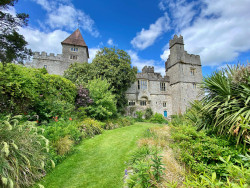
- Lismore Heritage Town: Walk past the dramatic Lismore Castle and cross the River Blackwater, exploring one of Ireland's most beautiful and historic estate towns.
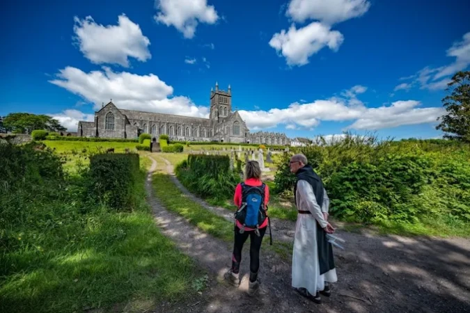
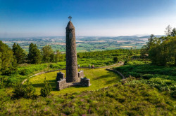
- Ardmore Monastic Ruins: The final destination features a beautifully preserved 12th-century Round Tower, St. Declan's original monastery, and his historic stone grave overlooking the bay.
What to See and Do
- Collect Your Trail Stamps: Stop by local highlights like Barron’s Bakery in Cappoquin or the Lismore Heritage Centre to get your official pilgrim passport stamped.
- Walk the Annual Guided Pilgrimage: Join the official springtime multi-weekend group walks led by Knockmealdown Active, complete with marshals, dedicated water stops, and bus transfers.
- Climb the Bearna Cloch an Buideál: Take on the historic "Bottleneck Pass" during the mountain section to experience panoramic views over the plains of Tipperary and Waterford.
- Download the GPX Navigation: For independent walkers, the steering committee provides downloadable GPX files to sync with phone navigation software for stress-free trail-finding.